 Polish Polar DataBase
GLACIER TERMINUS
Type of resources
Available actions
Topics
Keywords
Contact for the resource
Provided by
Years
Representation types
Update frequencies
status
Scale
-
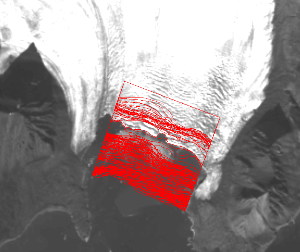
The position of the terminus of Hansbreen is derived with very high frequency in the period 1991–2015. Over 160 multispectral and Synthetic Aperture Radar (SAR) data were used: LANDSAT 5, LANDSAT 7, LANDSAT 8, Terra ASTER, Alos AVNIR, SPOT 5, ERS-1, ERS-2, ENVISAT, Alos PALSAR, TerraSAR-X, TanDEM-X, and Sentinel-1. Terra ASTER images were orthorectified with use of 2008 DEM SPOT and geocoded in PCI Geomatica and ArcGIS software. Multispectral, already terrain-corrected images were rectified in ArcGIS software. SAR data were provided at the Single Look Complex level and that both radiometric and geometric corrections were applied using the same methods, and with the same digital elevation model (2008 DEM SPOT). The SAR data were processed in BEAM (http://www.brockmann-consult.de/cms/web/beam). Sentinel data downloaded from the Sentinel’s Data Hub were already processed. The satellite data were digitized manually to obtain the front position. The database is the supplement to the paper: Małgorzata Błaszczyk, Jacek A. Jania, Michał Ciepły, Mariusz Grabiec, Dariusz Ignatiuk, Leszek Kolondra, Aleksandra Kruss, Bartłomiej Luks, Mateusz Moskalik, Tadeusz Pastusiak, Agnieszka Strzelewicz, Waldemar Walczowski, Tomasz Wawrzyniak. “Factors controlling terminus position of Hansbreen, a tidewater glacier in Svalbard”, Journal of Geophysical Research - Earth Surface, https://doi.org/10.1029/2020JF005763.
-
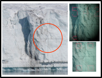
Changes in position of glacier front are obtained from a Riegl FG21-LR laser distance ranger (the temporal resolution of 10 minutes) taken during September 2009 – February 2013. The database is the supplement to the paper: Małgorzata Błaszczyk, Jacek A. Jania, Michał Ciepły, Mariusz Grabiec, Dariusz Ignatiuk, Leszek Kolondra, Aleksandra Kruss, Bartłomiej Luks, Mateusz Moskalik, Tadeusz Pastusiak, Agnieszka Strzelewicz, Waldemar Walczowski, Tomasz Wawrzyniak. “Factors controlling terminus position of Hansbreen, a tidewater glacier in Svalbard”, Journal of Geophysical Research - Earth Surface, https://doi.org/10.1029/2020JF005763.
-
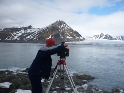
Average terminus height above sea level for the period 1992–1996, 2000 and 2010 was acquired with an accuracy of ±1.5 m, using terrestrial photogrammetry. The glacier terminus height in September 2009 and 2015 was measured using precise laser scanning with an accuracy of ±0.5 m. The height data obtained using photogrammetry and a laser scanner are averaged along the ice face. The database is the supplement to the paper: Małgorzata Błaszczyk, Jacek A. Jania, Michał Ciepły, Mariusz Grabiec, Dariusz Ignatiuk, Leszek Kolondra, Aleksandra Kruss, Bartłomiej Luks, Mateusz Moskalik, Tadeusz Pastusiak, Agnieszka Strzelewicz, Waldemar Walczowski, Tomasz Wawrzyniak. “Factors controlling terminus position of Hansbreen, a tidewater glacier in Svalbard”, Journal of Geophysical Research - Earth Surface, https://doi.org/10.1029/2020JF005763.